
Discover Puerto Rico's Natural Wonders
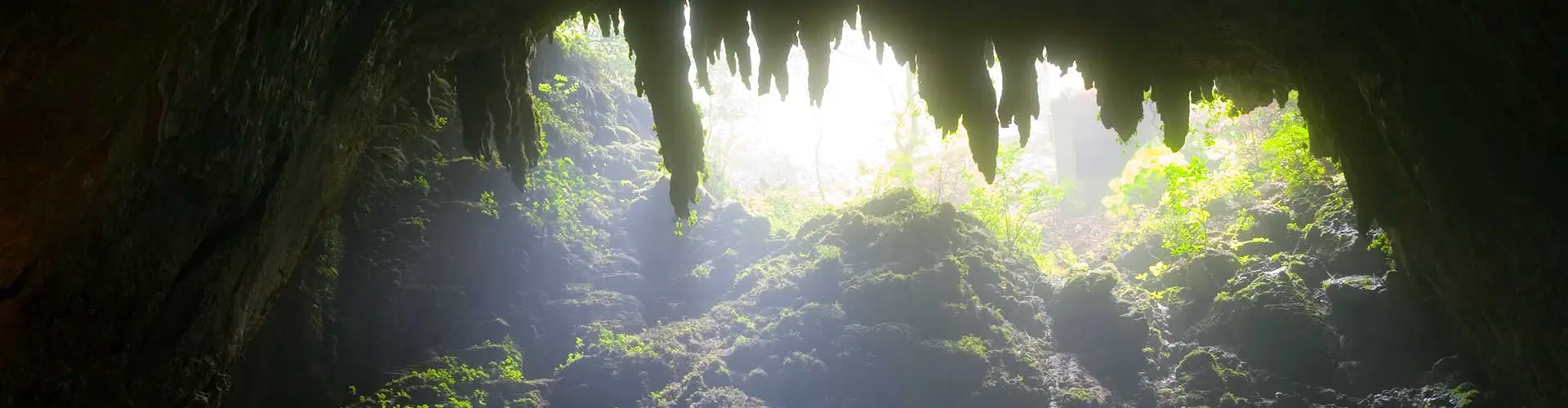
Puerto Rico is home to an incredible variety of natural landscapes, from towering limestone caves and lush rainforests to tranquil lakes, wildlife refuges, mangrove forests, and coastal wetlands. Whether you're hiking through a nature reserve, exploring an underground cave system, or enjoying panoramic mountain views, these destinations showcase the island's remarkable biodiversity and geological beauty.
Why Visit Puerto Rico's Natural Wonders?
Nature lovers will find no shortage of unforgettable experiences across Puerto Rico. Explore hidden caves, scenic reservoirs, protected forests, wildlife sanctuaries, and unique ecosystems that provide opportunities for hiking, birdwatching, photography, kayaking, and learning about the island's rich natural heritage. Many of these destinations remain peaceful escapes just a short drive from Puerto Rico's major cities.
Why I Love Puerto Rico's Natural Wonders
Growing up in Puerto Rico, I always appreciated how quickly the scenery could change. In a single day, you can stand inside a centuries-old cave, drive through cool mountain forests, watch birds along a mangrove lagoon, and finish with a sunset over a quiet lake. These natural places remind me that Puerto Rico offers so much more than beautiful beaches—they reveal the island's incredible diversity and make every road trip an adventure.
Must-See Natural Wonders
Cueva Ventana
One of Puerto Rico's most photographed caves, famous for its dramatic natural opening overlooking the Río Grande de Arecibo Valley.Cañón de San Cristóbal
One of Puerto Rico's most dramatic canyons, with towering cliffs, waterfalls, lush vegetation, and sweeping mountain views.Cabo Rojo National Wildlife Refuge
A haven for birdwatchers and nature enthusiasts, featuring scenic trails, salt flats, and coastal ecosystems.Laguna Grande
One of Puerto Rico's famous bioluminescent bays, where microscopic organisms create a magical blue glow at night.Guánica State Forest
A UNESCO Biosphere Reserve protecting one of the world's best-preserved subtropical dry forests.Río Camuy Cave Park
One of the largest cave systems in the Western Hemisphere, featuring massive caverns, sinkholes, and underground rivers.Explore Natural Wonders by Region: Metro · North · East · Central · South · West · Islands
Displaying 40 results.
Metro Region
-
Isla de Cabras
Located few miles to the west of El Morro. There is a beach area as well as the El Canuelo Fort.Toa Baja
(787) 261-0202
North Region
-
Cueva del Indio
Spectacular coastal cave known for ancient Taino petroglyphs, dramatic limestone cliffs, and panoramic Atlantic Ocean views.PR-681
Arecibo, 00612
-
Cueva Ventana
One of Puerto Rico's most famous natural attractions, featuring a large cave opening overlooking the Rio Grande de Arecibo valley. Guided tours required.PR-10 Km. 75.2
Arecibo, 00612
(787) 322-3554 -
Camuy Cave Park
This incredible 268-acre park is the site of the great subterranean caverns carved out by the Camuy River over one million years ago. The park is one of the largest underground formations in the Western Hemisphere, and only seven miles (11km) of this series of limestone caves have been fully explored. The impeccably maintained trails gently descend 200 feet through a fern filled ravine to the yawning, cathedral-like caverns. The park is one of the world's largest cave networks. Sixteen entranced have been found and 11 kilometers (7 miles) of passages explored so far. Tours available, visitors are guided through one cave and two sinkholes, there are fine examples of stalactites, stalagmites and, of course, plenty of bats. The park is equipped with picnic areas, walking trails, food facilities, and exhibition hall and a souvenir shop, making it the perfect place to spend a day. Southwest of San Juan, about a two-hour drive. Open Wednesday-Sunday 8am - 4pm; admission US$10 adults and US$7 children.Route 129, Km 9.8
Camuy
(787) 898-3100 -
Cueva Clara
One of Puerto Rico's largest limestone caves featuring impressive stalactites and stalagmites. Located within the Camuy River Cave Park system.PR-129
Camuy, 00627
(787) 898-3100 -
Tortuguero Lagoon
Considered the greater body of fresh water in the island.Vega Baja
East Region
-
Cabezas de San Juan Nature Reserve
Coastal nature reserve featuring mangrove forests, lagoons, coral reefs, walking trails, and the historic Cabezas de San Juan Lighthouse. Guided tours available.Road 987 Km. 5.9
Fajardo, 00738
(787) 722-5882 -
Laguna Grande Bioluminescent Bay
One of Puerto Rico's famous bioluminescent bays where microscopic organisms create a glowing blue effect. Best experienced on guided evening kayak tours.Las Croabas
Fajardo, 00738
-
Humacao Nature Reserve
Protected coastal reserve offering hiking trails, lagoons, kayaking, birdwatching, and diverse wildlife habitats along Puerto Rico's southeastern coast.PR-3 Km. 77.4
Humacao, 00791
(787) 852-3066 -
Refugio Vida Silvestre
Open Tue-Sun 6:30am - 6:30pm.Road 128, Km 12.3
Humacao
(787) 852-6088 -
El Portal Visitor Center
Modern visitor center for El Yunque National Forest featuring interactive exhibits, educational displays, theater presentations, and access to rainforest trails.PR-191 Km. 4.3
Rio Grande, 00745
(787) 888-1880 -
Espiritu Santo River
Espiritu Santo River is the only navigable river in Puerto Rico.Highway 3
Rio Grande
-
Rio Grande de Loiza
Puerto Rico's only navigable river.Route 187
Rio Grande
-
Ines Maria Mendoza Reserve
This 290-acre reserve, also known as Punta Yegua, with its rolling pastures and tree-lined sandstone cliffs is a place of great aesthetic value. On the reserve, there is a population of the very rare evergreen tree, Ortegon, as well as a bird in danger of extinction, the Grasshopper Sparrow.Yabucoa
Central Region
-
Bosque Estatal Guilarte
Monte Guilarte Forest Reserve is a beautiful and lush tropical site. The Forest is divided into seven segments which are located among the municipalities of Adjuntas, Guayanilla, Penuelas and Yauco. The trails are excellent for hiking and the views at the pinnacle are breathtaking. On a clear day you can see both Ponce and San Juan without the aid of binoculars. Monte Guilarte (3,953 ft) is the third highest mountain peak on the island.Rt. 518
Adjuntas
(787) 724-3647 -
Cascada Las Garzas
Small waterfall.Adjuntas
-
San Cristobal Canyon
The San Cristobal Canyon, one of the most notable topographic feature of the island, it is the largest canyon in Puerto Rico (and in the Caribbean). Three rivers cascade through its ravines, some of which are over 750 feet deep. It is also home to the highest waterfall in Puerto Rico, right on the Rio Usabon. Guided hiking trips are available, for more information, call the San Cristobal Hiking Tour at: (787) 857-2094 (787) 647-3402.Aibonito
-
La Virgen Cave
Ciales
(787) 871-3500 -
Las Archillas Cave
Ciales
(787) 871-3500 -
Las Golondrina Cave
Ciales
(787) 871-3500 -
Yuyu Cave
Ciales
(787) 871-3500 -
Cerro Punta
Located within the Toro Negro Forest Reserve lies the highest peak. Puerto Rico's highest peak (1,338 m).Jayuya
-
Tres Picachos
Road 143
Jayuya
(787) 828-1241 -
Gruta San Juan Bautista
Recreational park with kiosks and playgrounds.Road 410 Km 1.0
Maricao
(787) 838-2290 -
Chorro Dona Juana
Chorro Dona Juana is a scenic waterfall located along Route 149 between Villalba and Orocovis in Puerto Rico's Central Mountain Region. Easily accessible from the roadside, the natural pool and cascading falls make it a popular stop for visitors seeking a refreshing swim and picturesque mountain views.Route 149
Villalba
South Region
-
Caja de Muertos
Located 5 miles south of Ponce, the island is approximately 2.75 km wide by 1.85 km long, with a total area of 202 hectares. The island has no permanent inhabitants. Ferries leave from La Guancha. The island offers secluded beaches, snorkeling, hiking, and day-trip excursions by boat.Ponce
(787) 721-5495 -
Jobos Bay National Estuarine Research Reserve
National estuarine reserve protecting mangroves, seagrass beds, salt flats, and one of the Caribbean's most important coastal ecosystems.PR-301 Km. 7.1
Salinas, 00751
(787) 853-4617
West Region
-
Cabo Rojo Salt Flats & Wildlife Refuge
Protected coastal reserve with pink salt flats, birdwatching opportunities, scenic trails, and one of Puerto Rico's most unique ecosystems.PR-301
Cabo Rojo, 00623
(787) 851-2996 -
Isla Ratones
A small cay off Cabo Rojo reached by boat, known for coastal recreation and surrounding shallow Caribbean waters.Cabo Rojo
(787) 851-1025 -
Las Salinas
Cabo Rojo's historic salt flats, an important coastal landscape where salt has been harvested from seawater for centuries; this is a natural and cultural site rather than a swimming beach.Cabo Rojo
-
Gilligan's Island
Named for its resemblance to the well known American TV show, Gilligan's Island. The cay is located about a mile off Copamarina Beach Resort in Guanica. The perfect place for a day of sunning, swimming and snorkeling.Guanica
-
La Parguera Phosphorescent Bay
Millions of luminescent dinoflagellates light up when disturbed by movement; a tiny form of marine life, which produce sparks of chemical light when disturbed.Guanica
-
Cueva del Viento
Scenic limestone cave located near Guajataca Forest, popular with hikers and adventure seekers exploring Puerto Rico's karst region.PR-446
Isabela, 00662
-
Cartagena Lagoon Natural Reserve
The reserve is home of the most diverse and major number of bird species in the island. This number surpasses half of the registered species for the island, including migratory and native.Lajas
-
Isla de Magueyes
This island is located 55 feet of the coast of Lajas. The island possesses a small hill in the central part and caves, Guayacan and Mattei which possesses Taino Indias remains in its soil.Lajas
-
Maricao State Forest
Mountain forest renowned for cool temperatures, hiking trails, birdwatching, and spectacular panoramic views of western Puerto Rico.PR-120 Km. 16.2
Maricao, 00606
(787) 838-2290 -
Tropical Agricultural Research Station
USDA research facility with tropical plant collections featuring exotic trees, palms, orchids, spices, and self-guided educational gardens.Route 65
Mayaguez, 00680
(787) 831-3435 -
Isla de Mona (monkey island)
Mona is home of mangrove forest, coral reefs, 200-foot high cliffs and the world's largest marine-originated cave system. The island is managed by the Department of National Resources since 1975. Camping is allowed at Sardinera Beach. Visitors are welcome, but no more than a hundred visitors can be on the island at any time. You can reach Mona Island Wildlife Refuge by private charter, tour operators or fishing boats from Puerto Real in Cabo Rojo.Mona
(787) 721-5495 (787) 723-1616 -
Susua State Forest
The Susua Forest is located in the municipalities of Yauco and Sabana Grande. The highest elevation is 473 m. Facilities include: 15 campgrounds, bathrooms, and showers.Route 368
Sabana Grande
(787) 833-3700 (787) 724-1374
Islands Region
-
Culebra
Culebra is famous for its coral reefs and white sand beaches. Culebra can be reached by plane or ferry from Fajardo and offers accommodations and dining. Ferry services: passenger & car. Call for current departure time to make reservationCulebra
(787) 863-0705 (787) 863-0852
Local Tip
Many of Puerto Rico's natural attractions are located in protected areas with limited facilities. Wear comfortable shoes, bring water and insect repellent, and arrive early to enjoy cooler temperatures, better wildlife viewing, and fewer crowds.
Frequently Asked Questions
What are Puerto Rico's most famous natural attractions?
Some of the island's best-known natural attractions include Cueva Ventana, Río Camuy Cave Park, Guánica State Forest, Laguna Grande Bioluminescent Bay, El Yunque National Forest, and Cabo Rojo National Wildlife Refuge.
Are these attractions family-friendly?
Yes. Many nature reserves, lakes, and visitor centers are suitable for families, while some caves and hiking trails require a moderate level of fitness.
Can I visit these places year-round?
Most natural attractions are open throughout the year, although weather conditions may affect access to caves, trails, and waterways after heavy rain.
Do I need reservations?
Some guided cave tours, bioluminescent bay excursions, and educational centers require advance reservations, while many lakes, forests, and refuges are freely accessible during operating hours.
Did You Know?
San Juan is the largest home-based cruise port in the world.
Get Our Newsletter
Discover new places, local flavors, upcoming events, cultural stories, and some of our favorite finds from around the island.Read the Latest ¡La Isla! Newsletter
Follow Along


